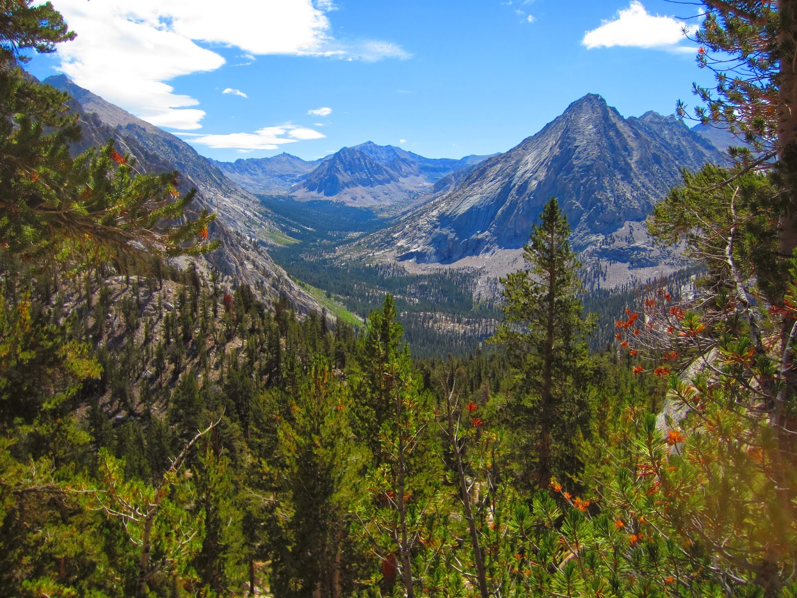
We awoke on Day 17 at an elevation of about 8,800 feet, deep in LeConte Canyon, next to the Middle Fork of the Kings River. Our itinerary that day started with a further descent into the canyon, down to 8,000 feet to the trail junction, where we turned uphill and began the climb up what is known as the "Golden Staircase". Nice name for a 2,500 foot climb. It was beautiful though - I love going up these canyons and coming out of the trees, or around a bend in the trail, and suddenly being able to look all the way back to where you started. This picture shows one of those views - the junction I mentioned is all the way in the bottom of that valley, at the base of the mountain in the background:
 |
| I am most of the way up the Golden Staircase here - on the way to Palisades Lake |
We camped that night at Palisades lake. It was another beautiful setting, and another good fishing spot. It was also a crystal-clear night and the stars were just amazing - the Milky Way stretched brilliantly from horizon to horizon.
 |
| Lower Palisades Lake, late afternoon |
 |
| A California Golden Trout from Palisades |
Here's a photo of Orion with the crescent moon taken at about 3:30 am, Orion is in the right half of the photo - the three stars of the "belt" should catch your eye and orient you:
On Day 18, we climbed up another 1,500 feet or so to Mather pass - this was the view looking back down to where we camped at Palisades:
 |
| With Midge, taking a break on the way up to Mathur Pass, looking back towards Palisades Lakes |
Midge is a truly amazing lady - she's 69 years young, about 5'2", a diabetic, two-time survivor of breast cancer, and tough as nails. She was usually either 2nd or 3rd in our climbing order up the passes (I was usually 6th of 7). She is a mountain climber, having attempted the ultimate prize, Mount Everest - unfortunately she had to turn around due to bad weather but she did make it to 26,000 feet - the "South Col". Just amazing, and she is great company too. Here we are at the pass, 12,100 feet:

On the left and center are Russ and his wife, Karen - Russ has owned a transmission shop for many years and Karen is a chef and caterer. Both were phenomenal hikers and great people. When we left VVR with 7 hikers, I was the YOUNGEST at age 51 - by 3 years. These people are role models for me! We descended from the pass and hiked another 5 miles or so to our campsite on the south fork of the Kings River. The next day, Day 19, it was UP AGAIN 2,000 feet to Pinchot Pass. Check out the color in these mountains:
 |
| Beneath Pinchot Pass |
We descended from the pass and camped at Twin Lakes, and you guessed it, it was beautiful. It was a big night because for the first time, I caught and kept fish for dinner - our guides were so excited! It took a little longer to get dinner going because of the chore of cleaning 12 brook trout - but it was worth it as Alex and Carlos whipped up fantastic fish tacos with Louisiana red beans and rice on the side - delectable!
Well, as usual I am going on a bit long...on Day 20, we did not have to go over a pass, but we had a 2,500 foot descent and a 2,000 foot gain up to our campsite at Arrowhead Lake - where I got a rare bath:
Of course, the water temperatures at these elevations were very chilly, and with the usual air temperatures in the 60s and a breeze blowing most of the time, we usually chose to skip the dunkings and just splash ourselves and smear the dirt around. But hey, once a week you just had to dive in and freeze.
This campsite at Arrowhead was really pretty, so I have to show you a couple more photos:
 |
| Looking North, down the drainage we climbed up |
 |
| Last Light over Arrowhead Lake |
The next day, Day 21, was the 5th and final of our resupply. It was typically grueling, except that our bear canisters were at their lightest, so my load was probably around 37 or 38 pounds. The Rae Lakes was our first beautiful photo opportunity - many people come for a week backpack trip into this area:
 |
| One of the Rae Lakes with Island and "The Painted Lady" in the background |
The view from Glen Pass looking towards the south:
Sorry this photo of our group got over-saturated. Our Guides are in the foreground. This is on top of Glen Pass, at around 12,000 feet.
Coming down off of the pass, this is the valley we descended in to:
This was the location of our last resupply - Vidette Meadow. After a 1500 foot gain to Glen Pass, we descended 2500 feet into the bottom of the valley, then climbed another 500 feet to our campsite along Bubb's creek. That evening, Mike and I enjoyed a small taste of a terribly expensive scotch whiskey he brought along - Johnnie Walker Blue Label - I didn't know there was such a thing but apparently it costs around $200 per bottle. Mike had been saving this for the day we summited Mt. Whitney but we took a little in advance just to make sure it was still good :-).
Well - it's true that the scenery just gets more dramatic and spectacular as one travels south along the John Muir Trail, and maybe that's why my 5-day "chapters" are getting longer. The next installment will be the final chapter which includes Forester Pass and Mount Whitney. I hope you'll join me. Here's a great photo of my hiking partner, Mike Nix, who was a great trail companion and really watched out for me all along the way - thanks Mike, it was an EPIC journey!
 |
| Mike, on the South side of Glen Pass, with Charlotte Lake in the background |


Hi Dan. As usual, your style of story-telling does a wonderful job of sharing the highlights of your journey. And your photography is just incredible. It must be a real chore for you now deciding which of these gorgeous art pieces you will frame and display. Great account - looking forward to the final chapter!
ReplyDelete