Sunday, October 27, 2013

Houston, We Have No Problems :-)

With Renee and AnneMarie Wallace, our "Pastor in Houston" and my host for the Awards Dinner
Hello all, it's Sunday evening and I'm watching a little baseball....we had a special week in Houston with my parents and my sisters.  They came to town to attend the MD Anderson Chaplaincy Fund's annual fund raising dinner, at which I was one of the speakers, giving the patient's perspective on the importance of the chaplaincy program at MDA.  It was a great evening, attended not only by my immediate family, but also my transplant doctor, Dr. Chitra Hosing, my Stephens Minister, Dorian Benn, my new pal from the JMT, Steve Roberts, the Archbishop of Houston, Daniel Cardinal DiNardo, and my dear friend and pastor from the First Presbyterian Church and Chaplaincy Fund Board member, AnneMarie Wallace (and another 200+ donors and guests).

With the FAM at the Rotary House on Saturday
We were also in Houston for my annual battery of tests - which also went well.  The main tests for cancer are the PET scan, which was negative, and the bone marrow biopsy - the biopsy results come in over a couple of weeks - the initial findings just say whether you have a normal proportion of the various kinds of blood cells in your marrow - and I passed that test.  The second test is called flow cytometry which examines individual cells to determine if any cancer cells are present.  I should get that result sometime next week.  I'll post a brief update then.  Thanks to all your prayers.  We feel very blessed.  Dan

Tuesday, October 15, 2013

Chapter 5 - Push to Mount Whitney and Civilization

Bubb's Creek in the foreground;  the path up to Forester Pass in the background
Chapter 5 starts with Day 22 and a 3,000 foot climb to Forester Pass, the highest pass on the JMT by over 900 feet.  The additional elevation caused a little anxiety, but we all topped out by 11 am or so.  This pass was also different in that it is very narrow and the south ridge is very steep, even a little dizzying - here I am at the top with Mike mugging in the background:


This was the view looking South, in our direction of travel:


Those clouds would build into a pretty solid rain as we were descending.  This photo gives you a flavor of the exposed and narrow trail descending the pass:


We walked through a rain shower which paused just long enough for us to have lunch, before it started raining again.  When we arrived at our campsite, "Frog Ponds", it stopped long enough for us to get our tents up, then started again and continued for about an hour and a half while we chillaxed in our dry shelters.  After the clouds blew away, we emerged from our tents in the late afternoon and I got this shot of a flat-top mountain - something we saw very rarely in the Sierra - with Frog Pond #2 in the foreground:


One more photo from this day - this was special - even Alex said he had not seen this effect before....I had crossed the meadow beside the ponds to get a higher perspective on the mountains to the west, where the sunset was taking place.  I think we've all seen sunsets where the sinking sun illuminates the bottom of a cloud deck from below - and that's what happened that evening....the cool part was that the mountains that were silhouetted and in deep shadow were glowing with the reflection off of the clouds above:


I remember seeing a quote on a plaque in Zion National Park that went something like this:  "Who can behold these wonders and not see the hand of God?"....that captures my feelings well.

So, onward to Day 23.  This was a big day because we got our first view of Mt. Whitney about mid-morning:

Mt. Whitney, 14,508 feet - the highest peak in the "lower 48",  coming into view
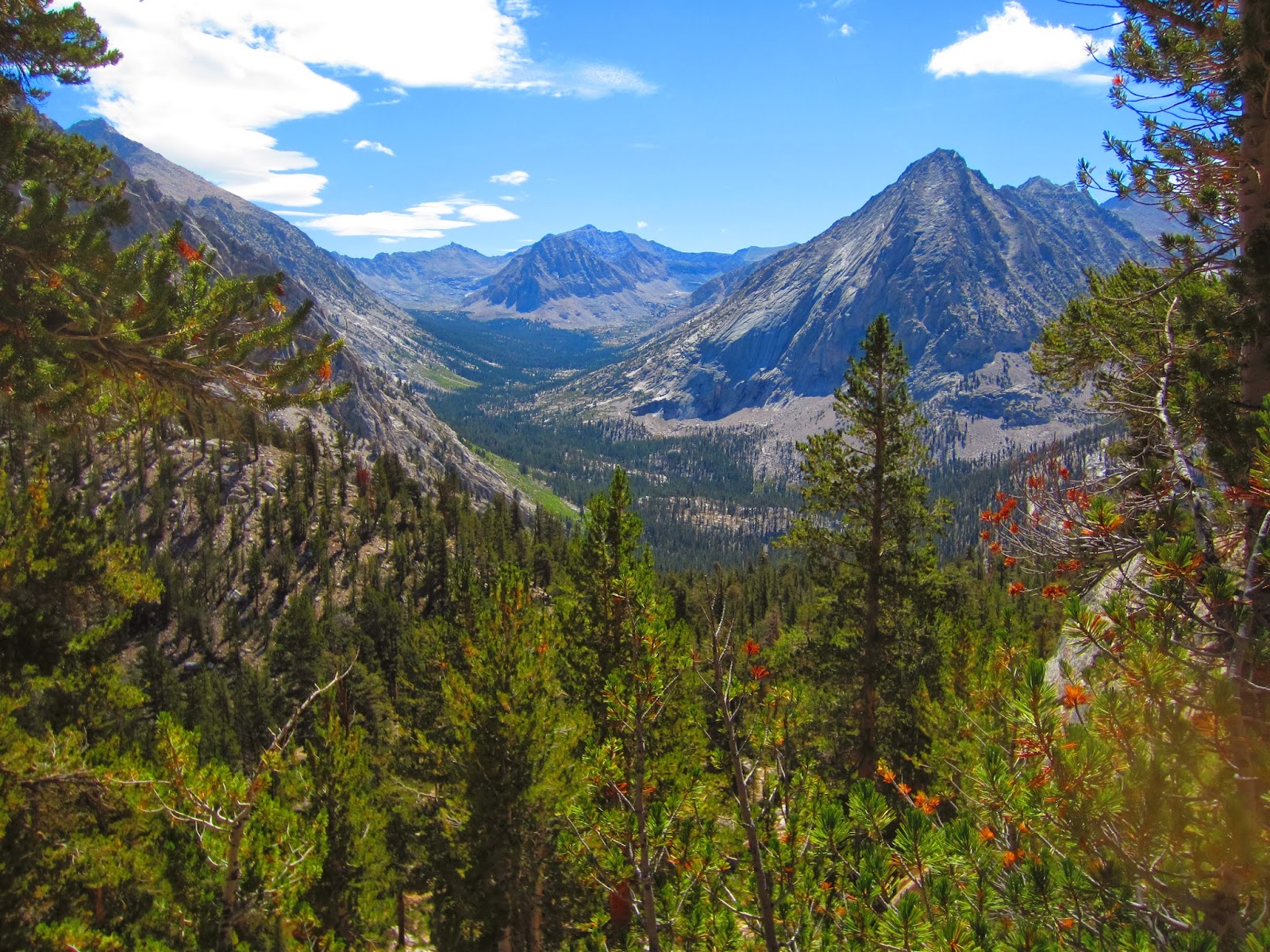
 Our destination for this day was Guitar Lake, which would also serve as our base camp for our attempt on Mt. Whitney.  Guitar Lake sits at 11,500 feet, well above the tree-line and our highest camp of the trip by 700 feet or so.  We camped above the lake - if you look closely in the center-left of this photo, you can see several tents down nearer the water.  Gives perspective.


Something really remarkable happened at Guitar - one of our initial group members - Sarah from Savannah - after quitting the trip back at the Vermillion Valley Resort (stomach bug) and poking around the Bay area for a few days - joined another SYMG trip, a cross-Sierra excursion of about 10 days.  She had been told by Ian that that particular trip would probably be at Guitar Lake on the same day as we would, and so - as we sat on the rocks in the afternoon, this lady in a blue coat starts making her way up the hill toward us.  Mike says "she looks and walks like Sarah".  I say, "nah, and anyway it can't be Sarah, she's surely back in Georgia".  We continue to watch her walk up the hill.  Mike: "she's waving at us".  Me:  "that's because we're staring at her".  Well, of course eventually we all realized that it was really Sarah and I ate my words - this is Midge giving her a big hug:


We were all pretty knocked out by Sarah's reappearance and we sat around for an hour or so listening to her wild account of the previous two weeks and everything that happened after we parted ways at VVR.  It was really extraordinary.

So now onward to summit day, Day 24, which started with my watch beeping at 3:20 am....I would say it woke me up but I didn't sleep much and apparently none of us slept well.  This was my second oh-dark-hundred ascent - the first one was of Mt. Kinabalu, in the Malaysian state of Borneo back in 2002.  We hit the trail at about 4:15, very happily unencumbered by all our grear - this was a day-hike so all we needed to bring were our clothes, water, and a few energy bars.  This is my first photo of the day, taken around 4:30 am:
From left, Carlos, Ron, Mike, Midge - smiling even at 5 am :-)
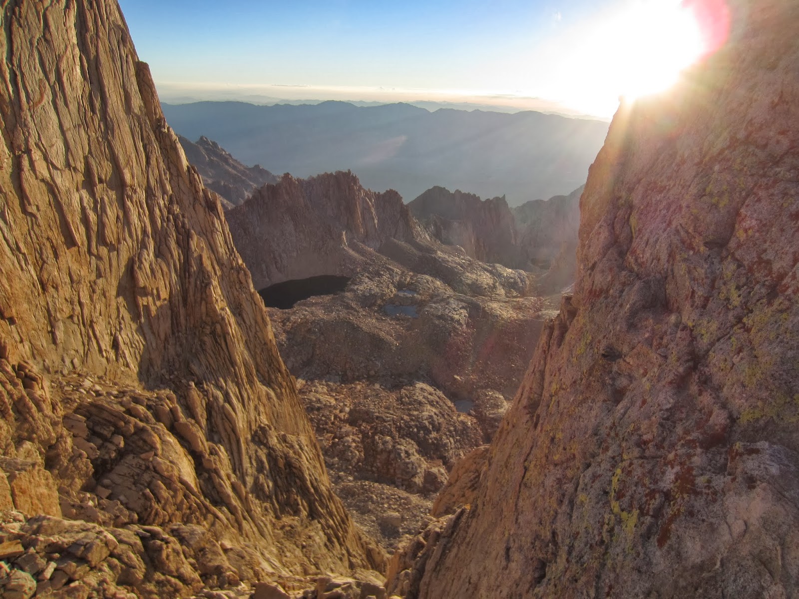
 We climbed in the dark, using our headlamps to light our way, and as we switchbacked up the ridge, the first cold glow of dawn lighted up the giant wall opposite our trail:


It pains me to know how impossible it is to get perspective from these two-dimensional photographs - for example, the lakes really don't look like they are 1500 feet below where I am standing, but they were.  The trail by this time was often narrow, exposed, and accompanied by precipitous drop-offs.  Geographically, the ridge that Mt. Whitney sits atop is very near the easternmost edge of the Sierra.  The mountains fall away dramatically down to the Owens valley, in extreme eastern California and adjacent to Death Valley and the Mojave desert.  None of that topography had been visible to us for the duration of our hike, and as we neared the top of the mountain, there were a couple of "notches" in the ridge wall where sunlight was streaming through from the east - in absolutely glorious colors.  This was another in the accumulating signals that we were near the end of our journey.  Here is what it looked like:

To the right is west, to the left, east and the desert.
In the center of this photograph is Guitar Lake, 2500 feet below - you can see where it gets it's name.  This captured the first light on the high peaks towards the north and west.


 One more shot before the summit - again, looking through a notch on the ridge towards the east:


I know I can't convey the emotion that I felt as I made the final steps to the summit, but I can tell you that I was overcome thinking about how far I had come - from a very bleak cancer diagnosis, but with a narrow and dangerous path back to health - two rounds of chemo that HAD to work in order to tee up the transplant - which of course had to work - then, slowly, everything working just right and in God's timing, I am completely restored.  To be blessed with a medical and spiritual miracle is amazing and I can honestly say that I am unworthy of it, and boundlessly thankful.  I am also thankful that if God had not chosen to extend my life, He would still be MY God and I would still be His child and enjoying Him forever.


I got the idea for this photo somewhere along the trail.  It is reminiscent of the poses I have seen military members assume near fallen comrades' boots and gear.  In the fight against cancer, there are literally millions of fallen comrades.  I am blessed to be able to continue the fight.


This one reminds me of many classic summit photos I have seen - shows how cold, windy, and exposed these places often are.  A "selfie".


My half-crazy buddy, Mike, scrambled out a narrow and sketchy rock wall to get to this perch, about 60 feet from the trail - he was then joined by our guide, Alex, who skipped across it like it was nothing - I stayed safely and sensibly on the trail in order to be able to take good photos.  And stay alive.


This is what Mt. Whitney did to all of us - Mike is merely exhibit A.  This is after descending to Guitar Lake - where we had to gather up our gear and hike 5 miles down the trail to our camp for the night, making it a 16 mile day with an elevation gain of 3,000 feet and loss of 4,500 feet.  Argh!


In honor of Ansel Adams, the greatest black and white landscape photographer who ever lived, I offer this last view of Mount Whitney, as we hiked away:


Well, as Alex put it, like every good book has a climax and then an ending - our trip's climax was our successful climb of Mt. Whitney, but we still had an ending to look forward to (or endure, as some saw it).  We ended Day 24 camping at Crabtree Meadows near a tumbling creek that had natural showers and pools which were great for getting scrubbed up.  Then, another 11 mile march on Day 25 to a lovely and secluded lake called Soldier Lake.  This lake had the most selective trout I have ever seen in the Sierra.  They were eating like crazy, feeds every few seconds at least - but they would not eat the flies I was throwing and I threw about 8 different kinds!  I could not "match the hatch" which appeared to be tiny gnats that were coming off the bushes and landing on the water.  Frustrating as it was, I take my hat off to these beautiful and sometimes finicky fish :-).  This is a visual taste of what Soldier Lake looked like in the late light:


For the last 2 nights, I had slept without the fly on my tent - the upper half of the inner shell is made with netting, so going without the rain fly has the effect of sleeping under the stars.  On most previous nights, there were passing clouds that could not be trusted, but these last few days and nights were mostly cloudless.  It is wonderful to awaken any time in the night and open your eyes to the glory of the night sky.  I remember one 5 minute stretch of being awake and seeing a meteor flash across my view, then two satellites cruising by and also finding the Great Galaxy in Andromeda, which was positioned overhead at that particular hour - fantastic.

Now comes Day 26 - we had another 10 or 11-mile haul to the trailhead, where we were met by a welcoming committee from SYMG - they put out a lunch spread that was sumptuous and also had a cooler full of very cold drinks for us:


The three Amigos, who hiked the entire trail, starting in Happy Isles, down in the heart of Yosemite Valley.  Enjoying a very cold and appropriate "Sierra Nevada Pale Ale".  We had a ride waiting for us which took us to a Best Western Motel in Lone Pine, CA, got cleaned up, caught a nap, called everyone, and headed out for a celebratory dinner, at which I took no pictures.  The next day (Day 27) we rode 5 hours in a bus back to Fresno and spent another night in a hotel waiting for our flight the next day.  And then, on Day 28, we flew east - back to Raleigh.

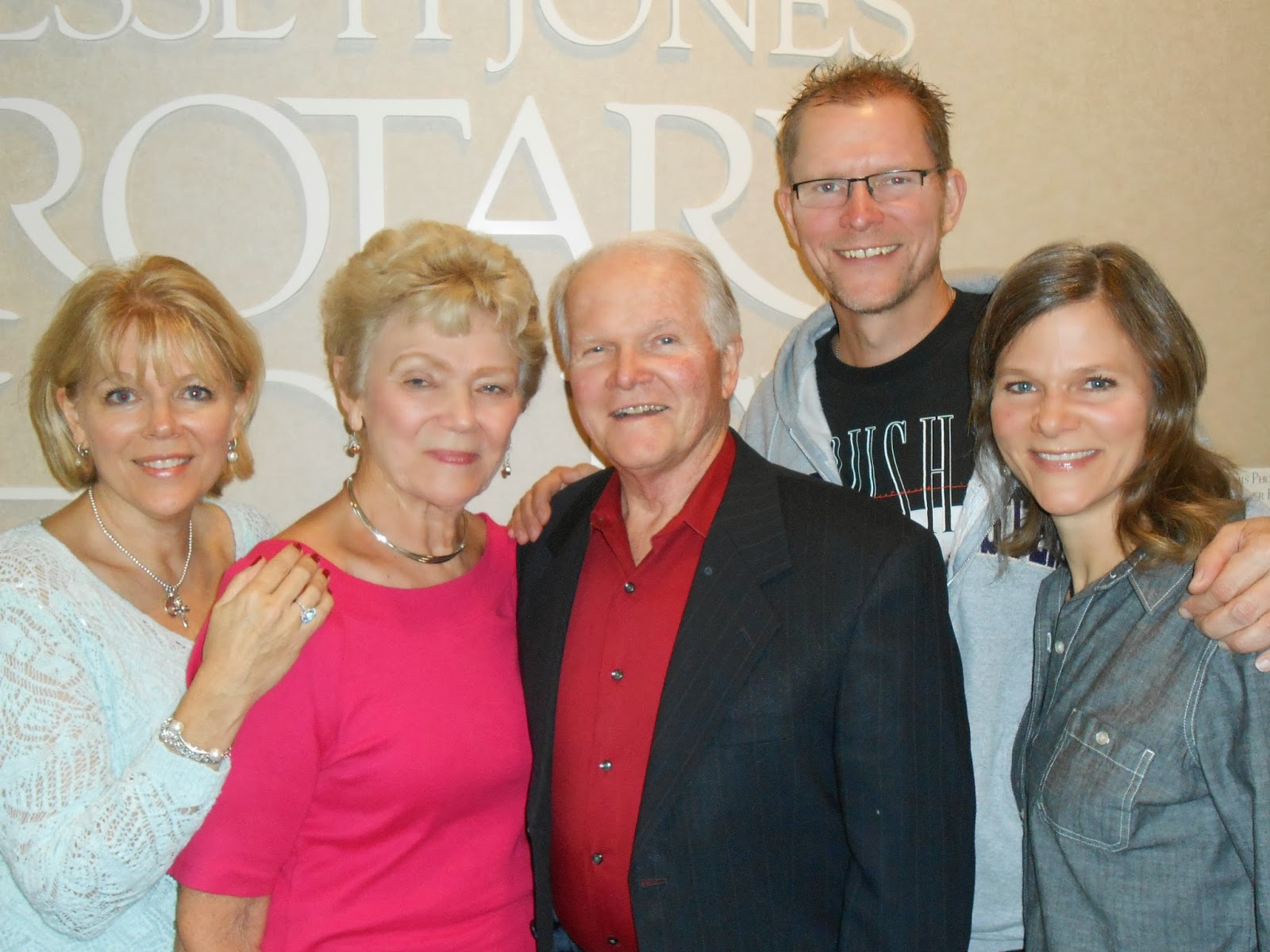
It was a joyous reunion to say the least.  Whoever said "absence makes the heart grow fonder" knew what they were talking about.  My appreciations of the wilderness, and my family bonds, my love for the little place we call home, all deepened and strengthened.  At the end of the day I will have raised over $130,000 for the Leukemia and Lymphoma Society, through the generosity of well over 100 donors, for the purpose of fighting and winning the battle against blood cancers.  I am deeply grateful for all your support.  I am also grateful for all of you prayer warriors who remembered to pray for me.  I think your prayers were answered in so many ways.  Praise God, from whom all blessings flow!  Here is my parting shot, inspired by the Muir Project's trademark photo of the hiking boots lined up:


Thanks to Southern Yosemite Mountain Guides - Ian, Alex, Carlos (WE ARE IN THE MOUNTAINS!!!) - for your commitment to excellence, your love of the wilderness, and your companionship.  Thanks to Steve, Younga, Bill, Sarah, David, Russ, Karen, Dave, Ron, and Midge - you made it great.  A very special thanks to Mike for making the big commitment to do this trail with me - love ya, man!  And to Tiffany and the gang at LLS for your partnership and support.  And Jeff - we did it just like you said we would - thanks for being such a great friend throughout my illness and recovery.  

Monday, October 7, 2013

Chapter 4 - Kings Canyon and Sequoia

We awoke on Day 17 at an elevation of about 8,800 feet, deep in LeConte Canyon, next to the Middle Fork of the Kings River.  Our itinerary that day started with a further descent into the canyon, down to 8,000 feet to the trail junction, where we turned uphill and began the climb up what is known as the "Golden Staircase".  Nice name for a 2,500 foot climb.  It was beautiful though - I love going up these canyons and coming out of the trees, or around a bend in the trail, and suddenly being able to look all the way back to where you started.  This picture shows one of those views - the junction I mentioned is all the way in the bottom of that valley, at the base of the mountain in the background:

I am most of the way up the Golden Staircase here - on the way to Palisades Lake
We camped that night at Palisades lake.  It was another beautiful setting, and another good fishing spot. It was also a crystal-clear night and the stars were just amazing - the Milky Way stretched brilliantly from horizon to horizon.

Lower Palisades Lake, late afternoon

A California Golden Trout from Palisades


 Here's a photo of Orion with the crescent moon taken at about 3:30 am, Orion is in the right half of the photo - the three stars of the "belt" should catch your eye and orient you:


On Day 18, we climbed up another 1,500 feet or so to Mather pass - this was the view looking back down to where we camped at Palisades:

With Midge, taking a break on the way up to Mathur Pass, looking back towards Palisades Lakes
Midge is a truly amazing lady - she's 69 years young, about 5'2", a diabetic, two-time survivor of breast cancer, and tough as nails.  She was usually either 2nd or 3rd in our climbing order up the passes (I was usually 6th of 7).  She is a mountain climber, having attempted the ultimate prize, Mount Everest - unfortunately she had to turn around due to bad weather but she did make it to 26,000 feet - the "South Col".  Just amazing, and she is great company too.  Here we are at the pass, 12,100 feet:


On the left and center are Russ and his wife, Karen - Russ has owned a transmission shop for many years and Karen is a chef and caterer.  Both were phenomenal hikers and great people.  When we left VVR with 7 hikers, I was the YOUNGEST at age 51 - by 3 years.  These people are role models for me!  We descended from the pass and hiked another 5 miles or so to our campsite on the south fork of the Kings River.  The next day, Day 19, it was UP AGAIN 2,000 feet to Pinchot Pass.  Check out the color in these mountains:

Beneath Pinchot Pass
  We descended from the pass and camped at Twin Lakes, and you guessed it, it was beautiful.  It was a big night because for the first time, I caught and kept fish for dinner - our guides were so excited!  It took a little longer to get dinner going because of the chore of cleaning 12 brook trout - but it was worth it as Alex and Carlos whipped up fantastic fish tacos with Louisiana red beans and rice on the side - delectable!


 Well, as usual I am going on a bit long...on Day 20, we did not have to go over a pass, but we had a 2,500 foot descent and a 2,000 foot gain up to our campsite at Arrowhead Lake - where I got a rare bath:


Of course, the water temperatures at these elevations were very chilly, and with the usual air temperatures in the 60s and a breeze blowing most of the time, we usually chose to skip the dunkings and just splash ourselves and smear the dirt around.  But hey, once a week you just had to dive in and freeze.

This campsite at Arrowhead was really pretty, so I have to show you a couple more photos:


Looking North, down the drainage we climbed up

Last Light over Arrowhead Lake
The next day, Day 21, was the 5th and final of our resupply.  It was typically grueling, except that our bear canisters were at their lightest, so my load was probably around 37 or 38 pounds.  The Rae Lakes was our first beautiful photo opportunity - many people come for a week backpack trip into this area:

One of the Rae Lakes with Island and "The Painted Lady" in the background
The view from Glen Pass looking towards the south:


Sorry this photo of our group got over-saturated.  Our Guides are in the foreground.  This is on top of Glen Pass, at around 12,000 feet.


Coming down off of the pass, this is the valley we descended in to:

This was the location of our last resupply - Vidette Meadow.  After a 1500 foot gain to Glen Pass, we descended 2500 feet into the bottom of the valley, then climbed another 500 feet to our campsite along Bubb's creek.  That evening, Mike and I enjoyed a small taste of a terribly expensive scotch whiskey he brought along - Johnnie Walker Blue Label - I didn't know there was such a thing but apparently it costs around $200 per bottle.  Mike had been saving this for the day we summited Mt. Whitney but we took a little in advance just to make sure it was still good :-).

Well - it's true that the scenery just gets more dramatic and spectacular as one travels south along the John Muir Trail, and maybe that's why my 5-day "chapters" are getting longer.  The next installment will be the final chapter which includes Forester Pass and Mount Whitney.  I hope you'll join me.  Here's a great photo of my hiking partner, Mike Nix, who was a great trail companion and really watched out for me all along the way - thanks Mike, it was an EPIC journey!
Mike, on the South side of Glen Pass, with Charlotte Lake in the background


Saturday, September 28, 2013

Chapter 3 - A Fresh Start and Into the Wild

Greetings everyone.....I will start this Chapter with a brief backtrack into Chapter 2 - many of my family and friends were concerned about how the fires in Yosemite affected us - the answer is that they did not affect us, thankfully - but on Day 10, as we climbed up the ridge to Chief Lake, we could see an enormous cloud of smoke billowing up out of the north/northwest.  The guides estimated that it was in southern Yosemite or just south of Yosemite, but we were 25 or so trail miles out of the park.  We could see the cloud growing in height and length, so we were pretty sure it was calamitous.  But the main point is that we were not threatened by it nor did we get smoked on.  This is what we saw:


So, on to Chapter 3.  I will try to hit the highlights and be a little less verbose.  As we saw in the last chapter, VVR is an inflection point in the trip.  It's the second and last chance to easily excuse yourself from the journey.  After VVR, there are no more campgrounds, roads, showers, toilets, etc.  If you want to quit, you have to walk out - or of course, if you are injured, SYMG can call a forest service helicopter - but that's reserved for serious injury, not just having a belly ache or sore feet.  The remainder of the trip divides nicely into 3 5-day sub-journeys, with the food re-supplies being the dividing events.  The contents of our bear canisters became a defining feature of each day.  The first day after a re-supply, the cans were at their heaviest - about 15 pounds.  Each day, as we consumed food, they got lighter, all the way down to 3-5 pounds on the 5th day.


So, with 7 hikers and 2 guides, we set out from VVR on Day 12 and were able to get a BOAT RIDE back across Lake Edison!  That was a good start.  Once we got off the little john-boats, we had full bear cans and a 2200 foot ridge to climb - aptly named Bear Ridge. It was tough going, but we all made it and camped by Bear Creek.  Mike had by this time watched me fish enough that he was able to spot fish in the streams and lakes - on this evening, he directed me to a group of trout that were feeding in very shallow water - I landed 3 total, and 2 of them were California Golden Trout - a species that is native to and only found in the High Sierra - a coveted prize.  This is what they look like:


As we settled in for the night, I took this picture of one of my companion's tents and the darkening sky:


Well, let me speed along a bit - every day is a climbing or descending (or both) day, and we made our way on Day 13 south past the south fork of the San Joaquin river and up into the Evolution Valley drainage - then on Day 14 a gorgeous hike (is "gorgeous" related to "gorge"?) up Evolution Creek and into what Alex calls the best campsite in the Sierra - pictured here:


I was fishing just about every day by now, and catching lots of fish - in Evolution creek on the right in the photo above, I caught 20 fish in about an hour and a half.  This meadow (MacLure Meadow) sits at about 9500 feet.  The next day, Day 15, we only hiked 4 miles and were treated to a half day of rest at Evolution Lake, another high altitude stunner:


From there, on our final day of this 5-day re-supply, Day 16, we headed up to Muir Pass - near 12,000 feet.  The wind was raging but we were able to get a little shelter from the storm in the Muir Hut:


As we started down the other side, I was stunned and amazed by the scenery.  I think I realized then what the difference is between the mountains of Yosemite and the southern high Sierra - the latter is much higher, the mountains are packed tightly together, they have much more color variation and they seem more jagged - I don't know if this picture conveys that, but here it is:


After our 2,000 foot climb to the pass, we descended another 3,000 feet into the LeConte Canyon.  As we were going from the moonscape at the pass lower and lower, there was  more and more vegetation until we had descended into the forest near the bottom of the drainage:


We had a very sheltered campsite in the trees that evening, and Carlos and Alex busied themselves with unpacking and organizing the the re-supply, which was brought in by a mule team led by a couple of cowboys on horses.  I busied myself in the nearby creek, where the fishing was excellent:

Nice example of a California Golden Trout - I think I landed 10 in about 45 minutes this evening.

LeConte Canyon Deer


So as Chapter 3 here draws to a close, there are 10 more days left in the wilderness, and we are keenly aware of the day count.  I was enjoying every day, but missing my family more and more, especially  Renee.  In the coming days, we have a lot of climbing and descending to do, a lot of fish to catch, and a lot of God's glory to behold.  More soon.